- Surface Geology
- Physiography
- Vegetation
- Climate
- Mean Annual Precipitation
- Mean Annual Temperature
- Indigenous Languages
- Mining and Industries
- Population
- Highways
- Railroads
- Roads
- Mexico City
- Merida
- Mazatlan
- Mexico City Public Transit
- Merida Public Transit
- Mazatlan Public Transit
- Mexico City Tourist Recommendations
- Merida Tourist Recommendations
- Mazatlan Tourist Recommendations
Physical Environment

Figure 1.1 This map shows agricultural areas in India.

Figure 1.2 Shows the physiography and landscape of India.
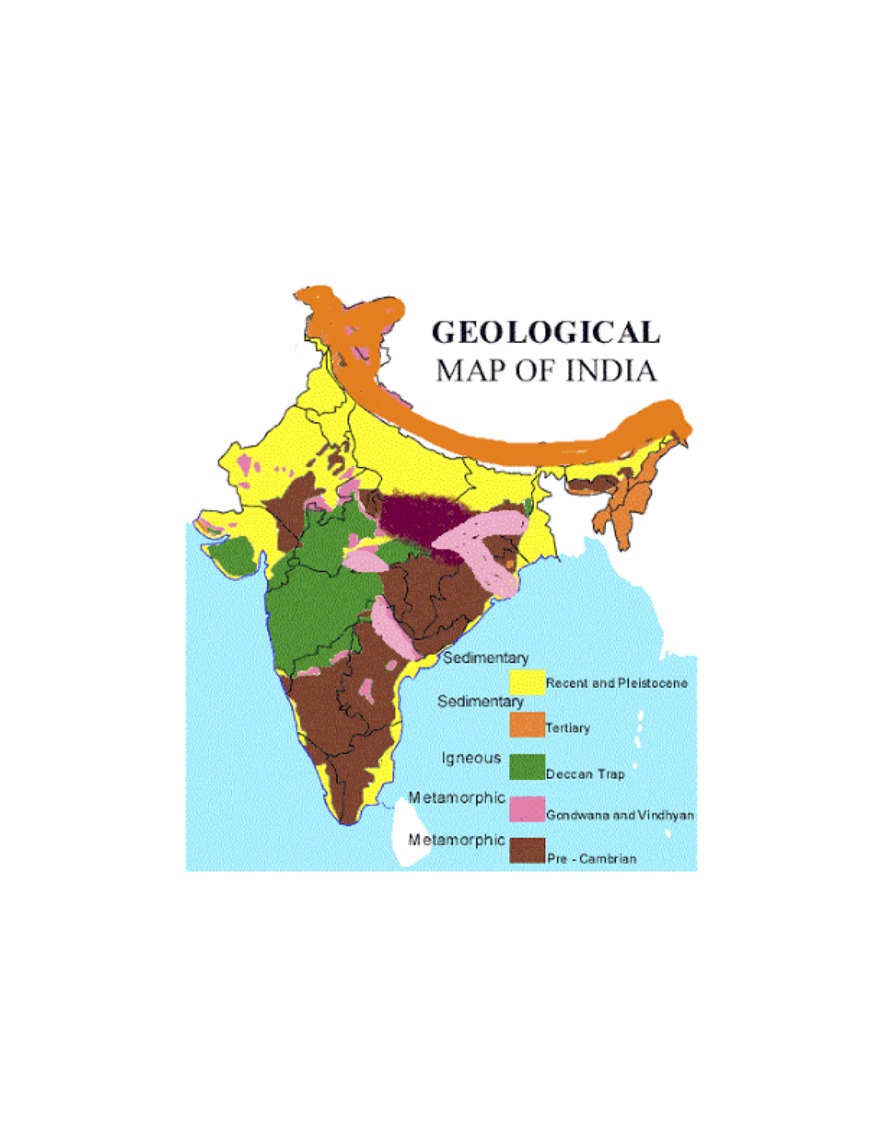
Figure 1.3 This map details the different types of sedimentary and geological contents in India.
Weather & Climate
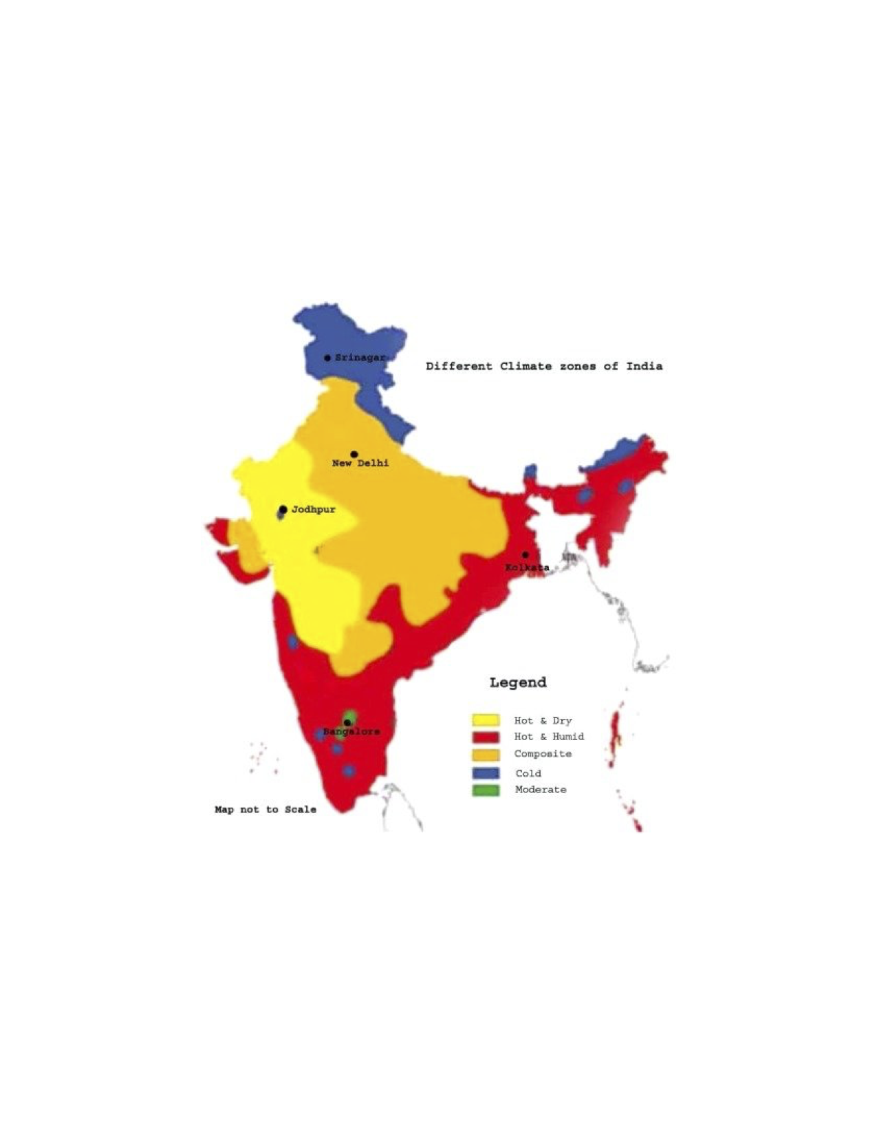
Figure 2.1 This map details the different Koppen Climate types throughout India.

Figure 2.2 This map shows annual flood outlook throughout India.

Figure 2.3 Map depicts the regions in India that get the most rain.
Human Environment

Figure 3.1 This shows what languages are spoken throughout India.

Figure 3.2 Depicts the average life expectancy in diffrent Indian regions.
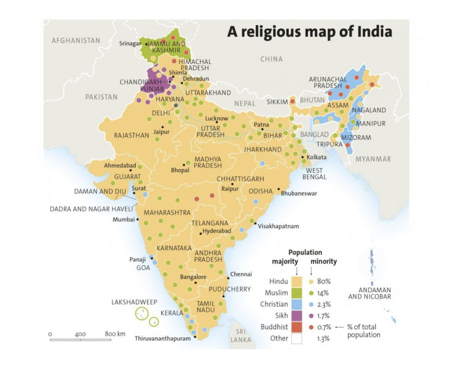
Figure 3.3 This shows the most popular religions throughout India
Road Maps
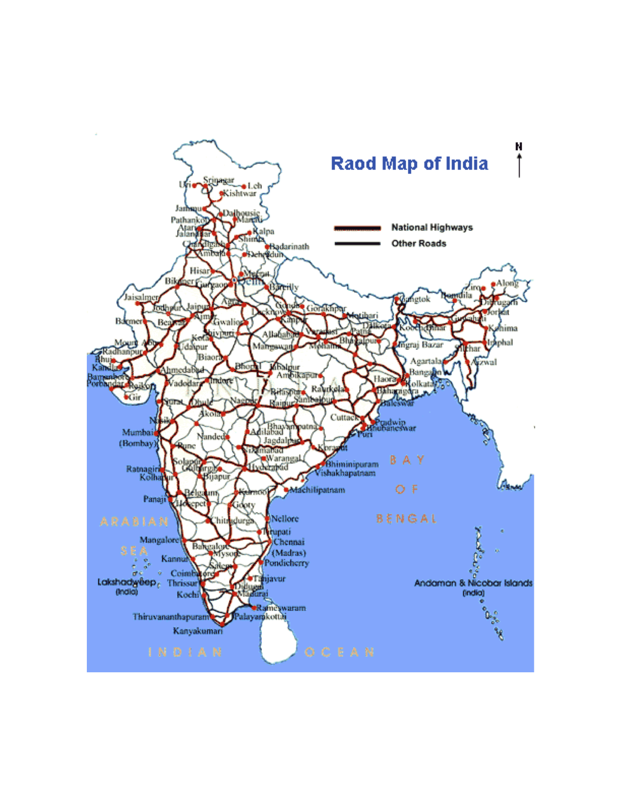
Figure 4.1 This map shows the various highways in India
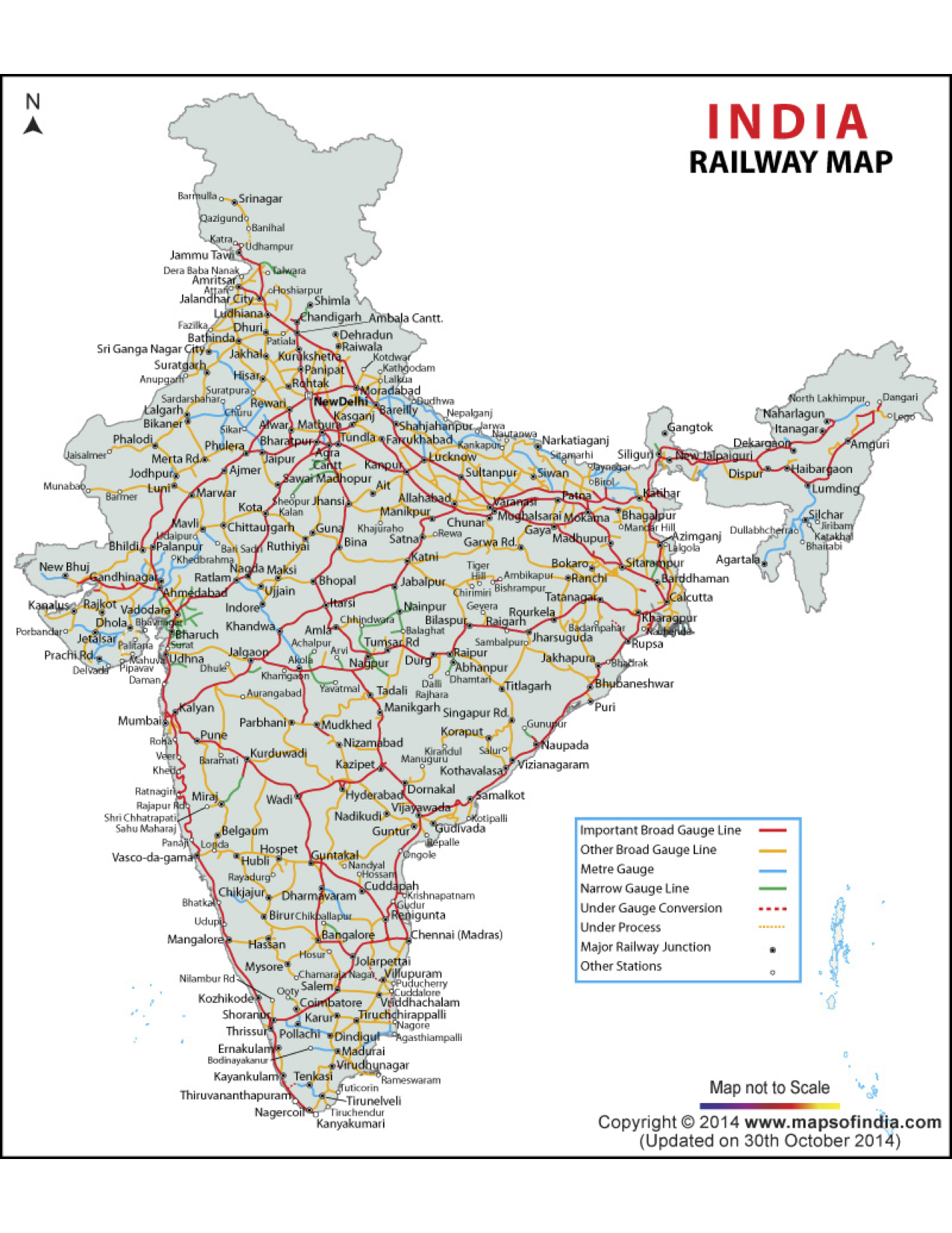
Figure 4.2 This map shows the various railways in India

Figure 4.3 This shows some lesser-known roads in India, those that shy away from highways.
City Maps

Figure 5.1 This is a detailed map of the Indian city, Dehli.
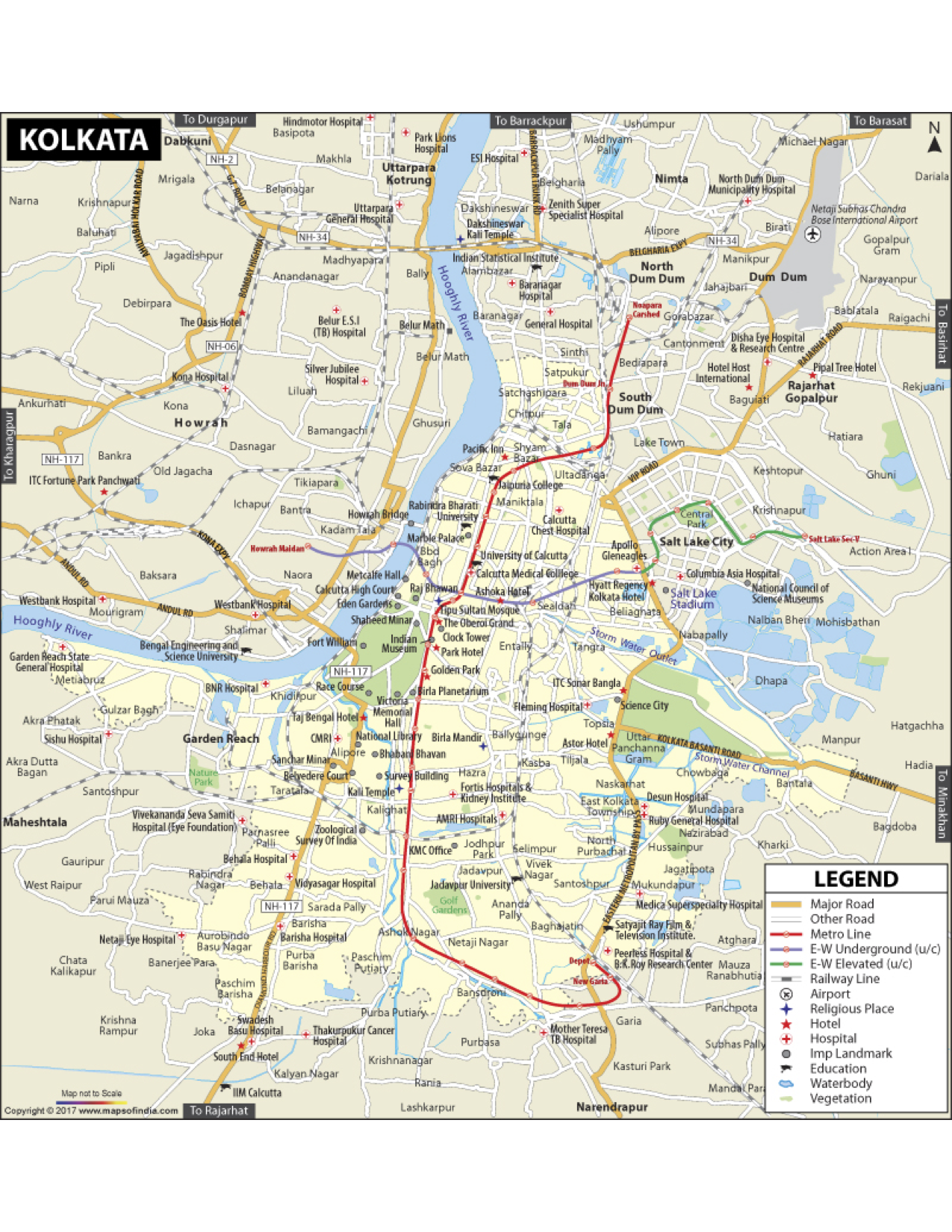
Figure 5.2 This is a detailed map of the Indian city, Kolkata.

Figure 5.3 This is a detailed map of the Indian city, Dehli.
Urban Transportation

Figure 6.1 This image shows where all the major airports.
![]()
Figure 6.2 This shows the locations of public transit stops in Dehli.

Figure 6.3 This depicts the train locations in Mumbai.
Tourist Sites

Figure 7.1 This map shows tourist locations throughout India
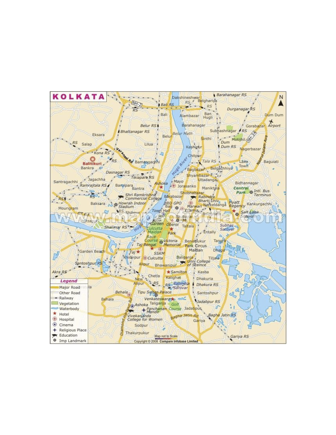
Figure 7.2 This map shows tourist locations in Kolkata.

Figure 7.3 This shows various tourist locations in Mumbai.
Submitted by Reggie Wortman on 3/6/2020